Search Results
Keyword(s): Coastal
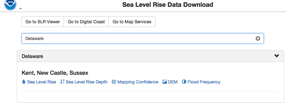
NOAA Sea Level Rise Data Download
Depository of data used in NOAA’s Sea Level Rise Data Viewer. Sea level rise, sea level rise depth, mapping confidence, flood frequency and a digital elevation model (DEM) is available to download by state.
Naturally Resilient Communities Strategies
A guide of nature-based solutions and related case studies of successful projects to help communities learn more and identify solutions that might work best for them. Explore over 50 nature-based solutions and case studies that can help your community …
NOAA Tides and Currents Innundation Dashboard
View real-time and historical water level and inundation information in an interactive web mapping application. Tide stations are available for three regions—New York City and Long Island Sound, Lower Chesapeake Bay, and coastal North Carolina—with add …
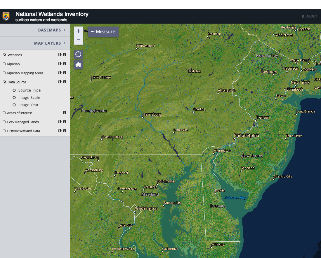
National Wetlands Inventory Wetlands Mapper
The Wetlands mapper is designed to deliver easy-to-use, map like views of America’s Wetland resources. It integrates digital map data along with other resource information to produce current information on the status, extent, characteristics and functi …
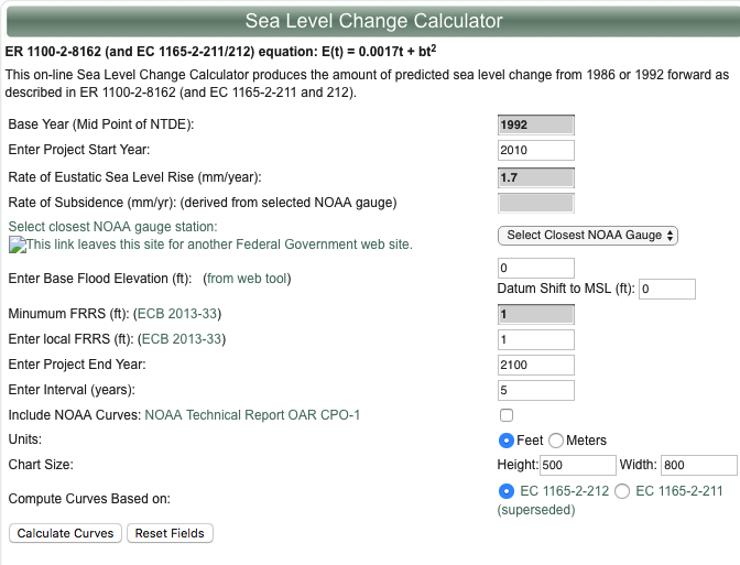
U.S. Army Corps of Engineers Sea-Level Change Curve Calculator
The online Sea Level Change Curve Calculator consists of a web-based tool that accepts user input such as project start date, selection of an appropriate NOAA long term tide gauge, and project life span, to produce a table and graph of the projected se …
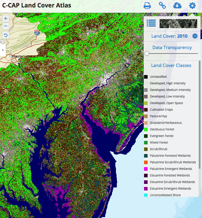
C-CAP Land Cover Atlas
This Data Portal serves as a platform to engage all stakeholders in the five coastal Mid-Atlantic states, putting all of the essential data and state-of-the-art mapping and visualization technology into the hands of the agencies, industry, community le …
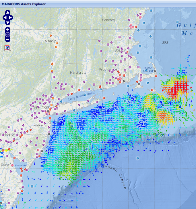
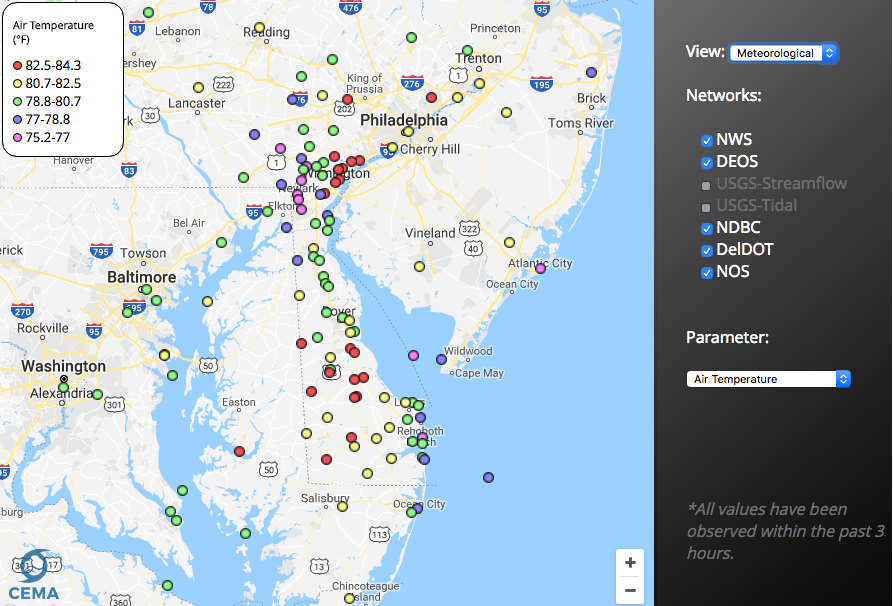
MARACOOS Assets Explorer
This site is designed to present near real-time observational assets and model forecasts that contribute to ocean monitoring in the MARACOOS domain. Numerous geographical representations of datasets are available including: ocean buoys, meteorological …
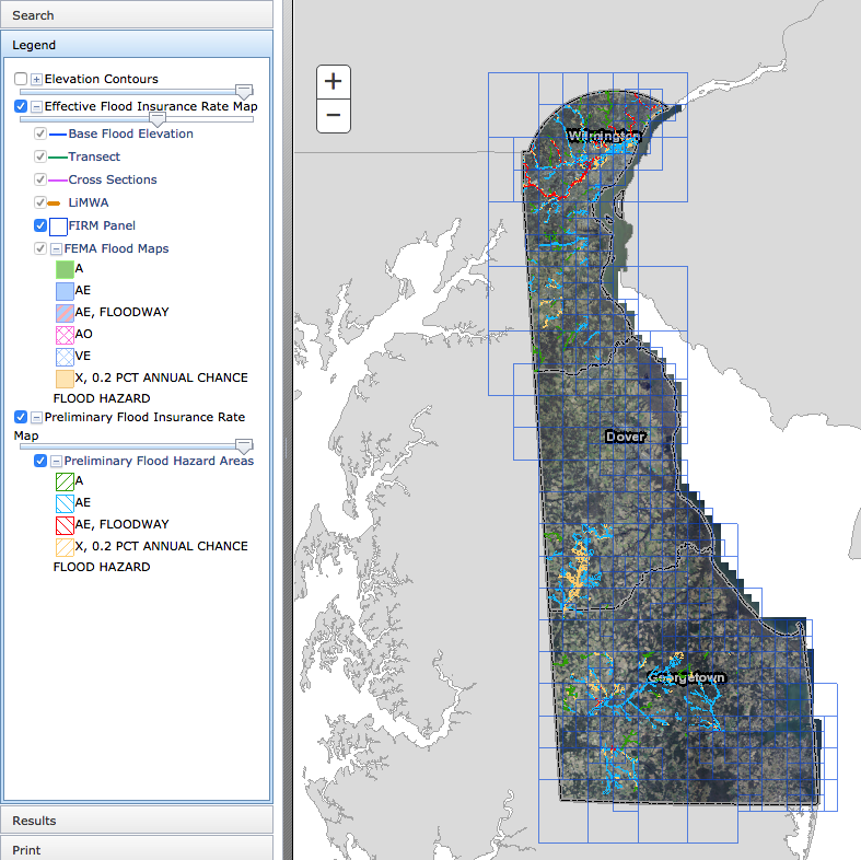
Delaware Flood Planning Tool
The DNREC Flood Tool is an interactive web map application. This tool is designed to aid you in researching your flood risk in the state of Delaware. It is designed to provide floodplain managers, insurance agents, developers, real estate agents, engin …
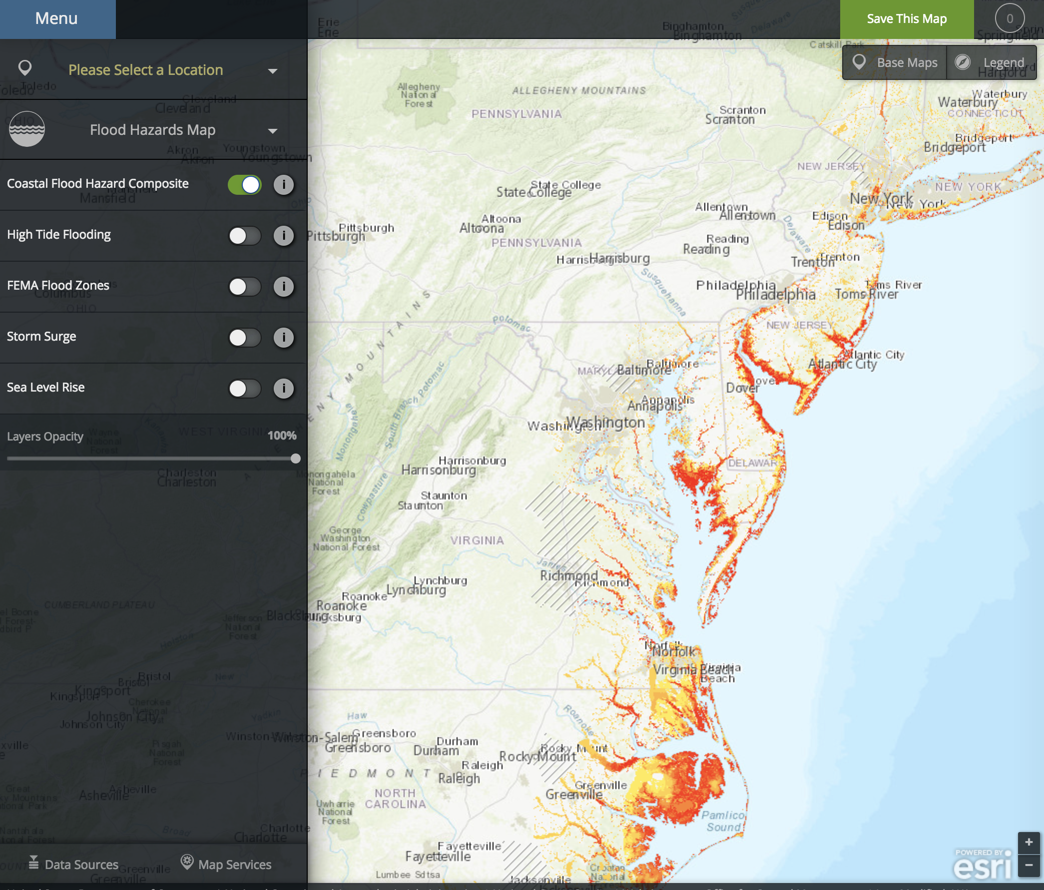
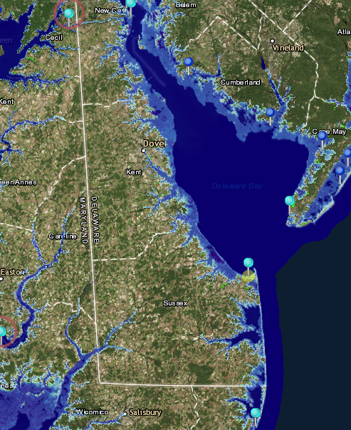
NOAA Coastal Flood Exposure Mapper
The Coastal Flood Exposure Mapper creates a collection of user-defined maps that show the people, places, and natural resources exposed to coastal flooding.
Delaware Environmental Observing System GeoBrowser
The Delaware Environmental Observing System (DEOS) GeoBrowser provides access to DEOS data through a geographic framework. In the GeoBrowser, you can select stations from across the state to see current conditions and access daily and monthly summaries …