Search Results
Keyword(s): GIS

Watershed Resources Registry- Delaware
The Watershed Resources Registry is an interactive online mapping tool that prioritizes areas for preservation and restoration of wetlands, riparian zones, terrestrial areas, and storm water management control across an entire state. The tool is helpfu …
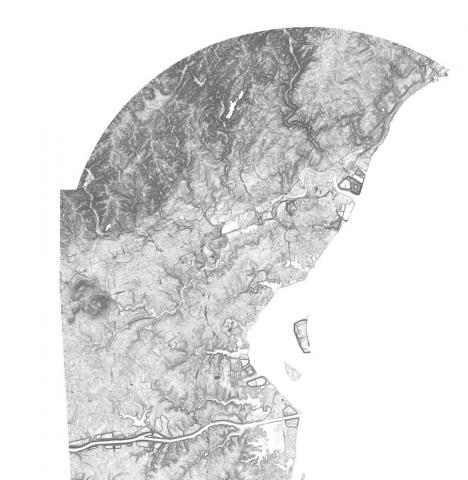
Elevation Contours Dataset for Delaware
Elevation contours at 1-foot contours were derived from a 2014 LIDAR DEM flown for the state of Delaware using a modified version of the USGS Contour Derivation algorithm. Elevation contour data are available for download.

National Wetlands Inventory (NWI) Wetlands Data
This website provides nationwide wetlands data in Geodatabase and shapefile form. Data is available for all 50 states and updated on a regular basis.
Delaware Geological Survey Digital Datasets
A depository of digital data released by the Delaware Geological Survey (DGS). It represents the results of original professional research used by professionals and the public.
Delaware First Map: Geospatial Data
FirstMap is a comprehensive self-service Enterprise Geographic Information System that consists of an enterprise geodatabase for data storage, an infrastructure to support geospatial and image services, and is tied into the State’s ArcGIS Online portal …
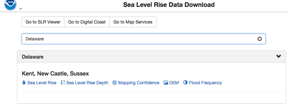
NOAA Sea Level Rise Data Download
Depository of data used in NOAA’s Sea Level Rise Data Viewer. Sea level rise, sea level rise depth, mapping confidence, flood frequency and a digital elevation model (DEM) is available to download by state.
Delaware 2ft Elevation Contours Map Service
This 2-foot contour dataset was created in a joint effort between the Delaware Geological Survey (DGS) and the U.S. Geological survey (USGS). These data are intended to provide both contour-data for use by the state of Delaware, and digital elevation d …
Delaware 2007 Land Use, Land Cover (Revised)
Revised in 2012, this land use/land cover (LULC) dataset corrects many of the errors found in the 2007 dataset. The imagery was collected with 4 bands: B, G, R, and NIR. The original, uncorrected 2007 LULC dataset is also available here.
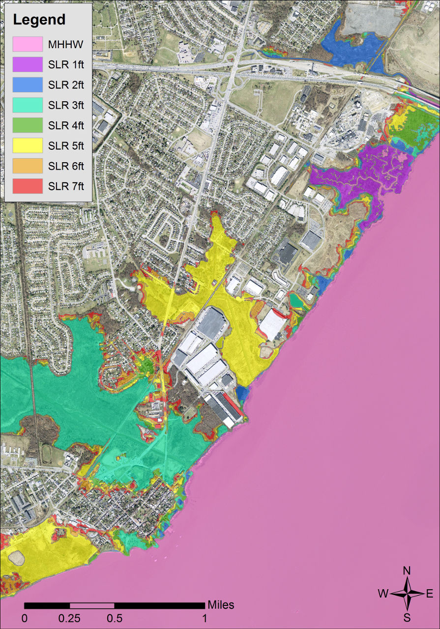
Delaware Coastal Inundation Maps
A new topographic DEM was used to develop bathtub-model coastal inundation maps for the state of Delaware. Both maps and GIS data layers are available from this project.