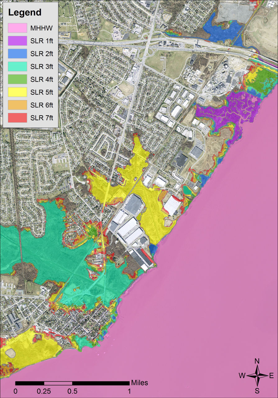
Data > Delaware Coastal Inundation Maps
These maps show coastal inundation in 1-foot increments which can help assess the potential impacts of sea-level rise and advise long-range planning of infrastructure, facilities, land management, land use, and capital spending. These inundation maps correspond to inundation scenarios and include surfaces from Mean Higher-High Water (MHHW) to 7 feet above MHHW.
In early 2014, topographic LiDAR was collected for the entire state of Delaware through a collaboration between the USGS, Delaware Geological Survey (DGS), Department of Natural Resources and Environmental Control (DNREC), and Delaware Department of Transportation (DelDOT), with funding through the Hurricane Sandy Supplemental Fund.
From these data, a seamless, statewide 1-meter, hydro-flattened, bare earth digital elevation model (DEM) was produced. This topographic DEM was used to develop these bathtub-model coastal inundation maps for the state of Delaware.
Resource Contact(s)
Delaware Geological Survey Contact Information
Email: delgeosurvey@udel.edu
