Search Results
Keyword(s): Planning
Delaware 2025 Climate Change Projections Report
In October 2025, the University of Delaware Center for Environmental Monitoring and Analysis (CEMA) published the Delaware 2025 Climate Change Projections Report. This report presents a comprehensive assessment of sea level rise, temperature, and preci …
Delaware Greenhouse Gas Inventory
In December 2025, the DNREC Division of Air Quality published Delaware’s Greenhouse Gas Inventory for 2022. The Division of Air Quality prepares the inventory to characterize Delaware’s historical and projected GHG emissions, and thereby inform the pol …
2025 Delaware Climate Action Plan
In January 2026, the Delaware Department of Natural Resources and Environmental Control published its updated Climate Action Plan for the next five years. The 2025 Climate Action Plan is a practical playbook to reduce greenhouse gas emissions, protect …

Watershed Resources Registry- Delaware
The Watershed Resources Registry is an interactive online mapping tool that prioritizes areas for preservation and restoration of wetlands, riparian zones, terrestrial areas, and storm water management control across an entire state. The tool is helpfu …
Delaware Resilient and Sustainable Communities League Coffee Hours
Join the Delaware Resilient and Sustainable Communities League (RASCL) for an informal and interactive discussion with RASCL members. Find the latest Coffee Hours scheduled here: https://www.derascl.org/events RASCL representatives are on hand to disc …
Delaware First Map: Geospatial Data
FirstMap is a comprehensive self-service Enterprise Geographic Information System that consists of an enterprise geodatabase for data storage, an infrastructure to support geospatial and image services, and is tied into the State’s ArcGIS Online portal …
Sediment and Stormwater Regulations Designer Training
The Sediment and Stormwater Program has developed a two-day Designer Training targeted at individuals who will be preparing plans and engineering computations under the Delaware Sediment & Stormwater Regulations. Visit the website for a list of upc …
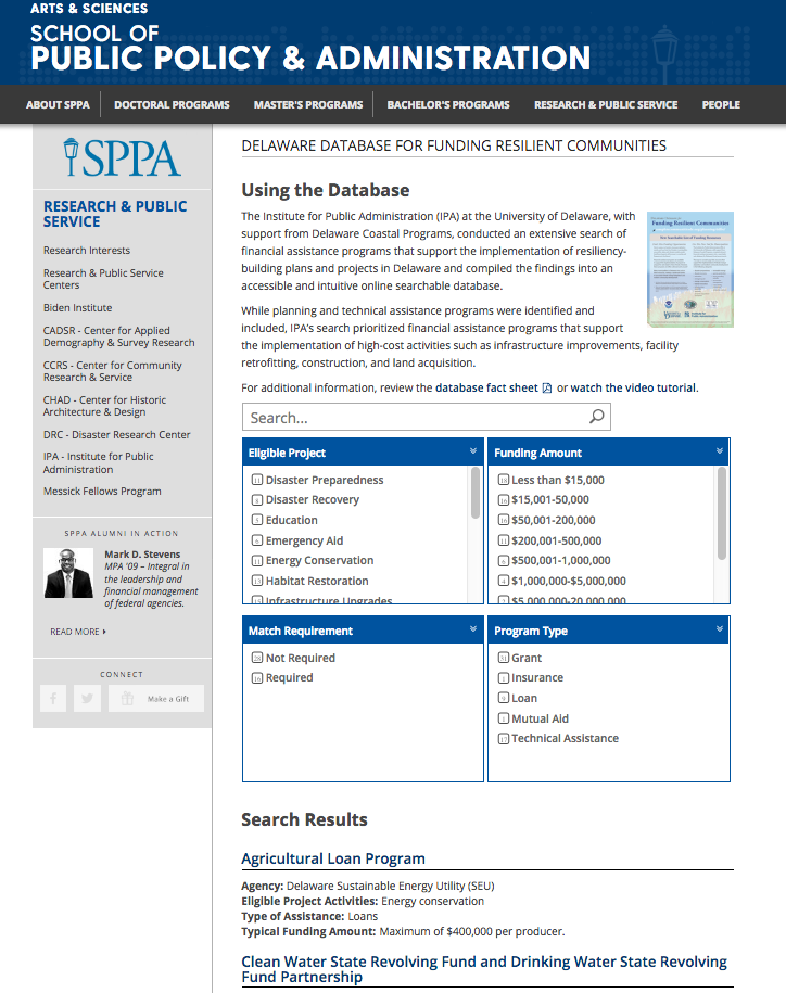
Delaware Database for Funding Resilient Communities
An online searchable database that provides information regarding financial assistance programs that support the implementation of resiliency-building plans and projects in Delaware.
NSF PREEVENTS
Prediction of and Resilience against Extreme Events (PREEVENTS) seeks projects that will (1) enhance understanding of the fundamental processes underlying natural hazards and extreme events on various spatial and temporal scales, as well as the variabi …
NSF Coastal SEES
Coastal SEES is focused on the sustainability of coastal systems. Coastal SEES projects will be expected to lead to generalizable theoretical advances in natural sciences and engineering while, at the same time, integrating key aspects of human process …