Search Results
Delaware Sea Level Rise Vulnerability Assessment Mapping Appendix
This Map Appendix was developed and produced by the DNREC Delaware Coastal Programs for use by the Delaware Sea Level Rise Advisory Committee. It contains background information about sea level rise, the sea level rise vulnerability assessment, and map …
Delaware Sea-Level Rise Initiative Project Compendium 2011
The purpose of the Sea Level Rise Initiative Compendium of Projects is to provide an at-a-glance inventory of the projects and initiatives are being conducted as part of the Delaware Coastal Programs’ Sea Level Rise Initiative. It is intended to help i …
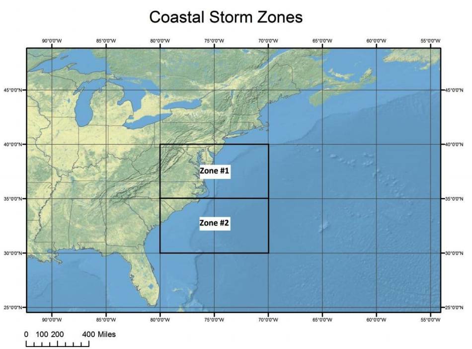
Delaware Coastal Storm Climatology and Damage Report: 1923-2009
As part of a cooperative effort between the University of Delaware and several Delaware State Agencies to better monitor conditions along the Delaware coastline and to provide advance warning of impending coastal flooding events, a climatology of coast …
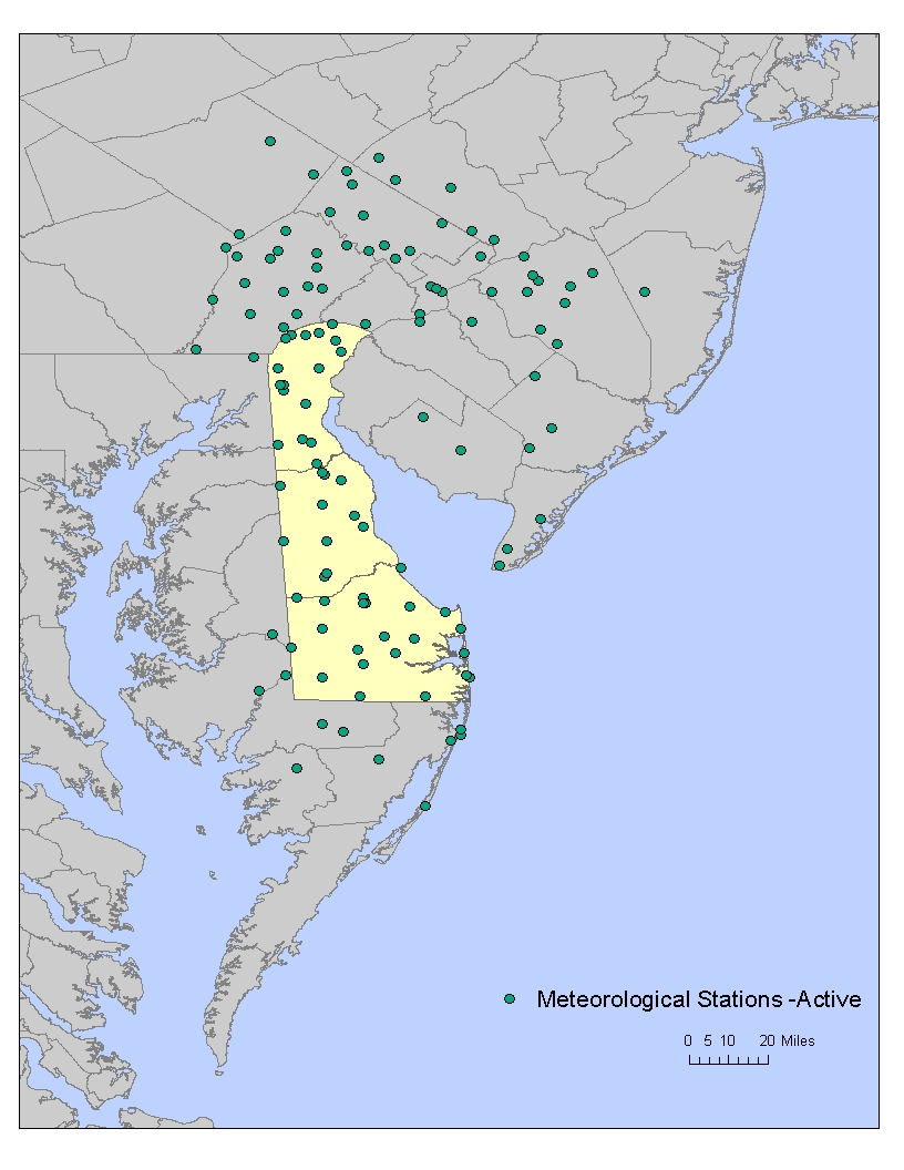
A Data GAP Analysis and Inland Inundation Survey for the Delaware Coastline:Final Report and Recommendations
The GAP Analysis defines the present state of coastal data collection efforts across the state, suggests an “optimum” data collection network for coastal flood monitoring and research, identifies “gaps” in the present network of stations and recommends data that need to be added to the current network configuration.
Delaware Residents Opinions on Climate Change and Sea Level Rise- 2009 survey
Recognizing the need to understand the public’s attitudes about climate change, the Delaware Department of Natural Resources and Environmental Control’s (DNREC) Delaware Coastal Programs contracted with Responsive Management, Inc., in 2009, to conduct …
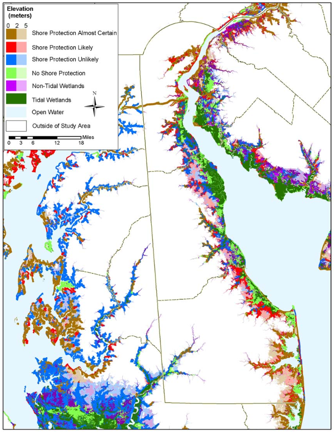
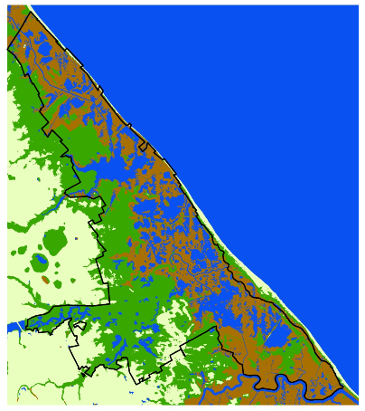
Delaware: The Likelihood of Shore Protection along the Atlantic Coast of the United States. Volume 1: Mid-Atlantic
This report to the U.S. Environmental Protection Agency describes the development of maps that distinguish shores that are likely to be protected from the sea from those areas that are likely to be submerged, assuming current coastal policies, developm …
Application of the Sea Level Rise Affecting Marsh Model (SLAMM) Using High Resolution Data At Prime Hook National Wildlife Refuge
The results of the SLAMM modeled scenarios for Prime Hook, and an explanation of the deviations from a similar modeling effort done for the region by the National Wildlife Federation.