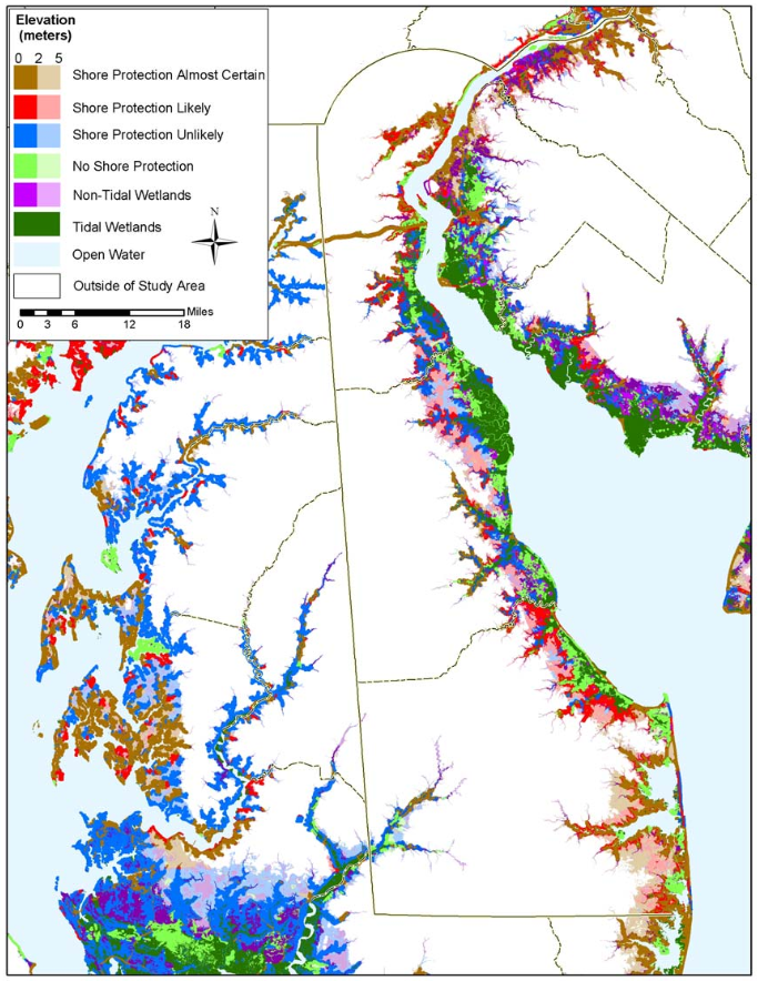
Projects & Reports > Delaware: The Likelihood of Shore Protection along the Atlantic Coast of the United States. Volume 1: Mid-Atlantic
This report to the U.S. Environmental Protection Agency describes the development of maps that distinguish shores that are likely to be protected from the sea from those areas that are likely to be submerged, assuming current coastal policies, development trends, and shore protection practices. Our purpose is primarily to promote the dialogue by which society decides where people will yield the right of way to the inland migration of wetlands and beaches, and where we will hold back the sea. We obtained the land use and agriculture preservation data for the state’s coastal zone and floodplain boundaries for New Castle and Kent counties, and consulted with planners representing the state’s three counties on how to best interpret the data given existing statutes, regulations, and policies. The result is a series of statewide maps that use existing data, filtered through the county governments who coordinate land use planning activities.
Resource Contact(s)
RisingSea.net Contact Information
Email: jtitus@risingsea.net
