Search Results
Keyword(s): Planning
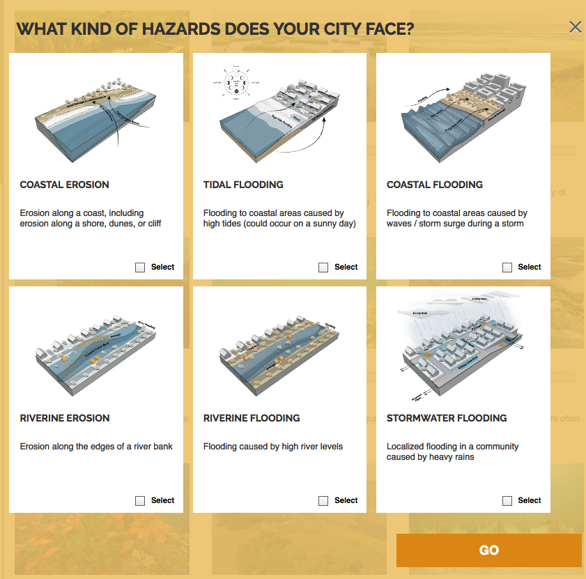
Naturally Resilient Communities Strategies
A guide of nature-based solutions and related case studies of successful projects to help communities learn more and identify solutions that might work best for them. Explore over 50 nature-based solutions and case studies that can help your community …
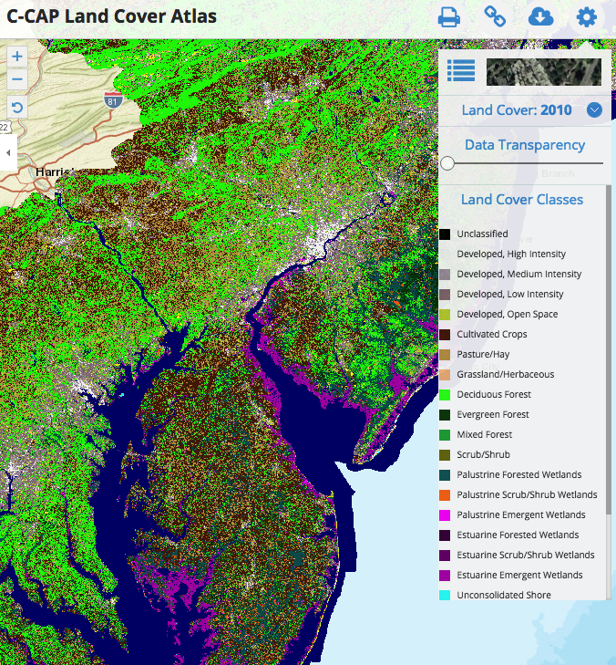
C-CAP Land Cover Atlas
This Data Portal serves as a platform to engage all stakeholders in the five coastal Mid-Atlantic states, putting all of the essential data and state-of-the-art mapping and visualization technology into the hands of the agencies, industry, community le …
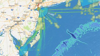
MARCO Map Viewer and Mid-Atlantic Ocean Data Portal
The Mid-Atlantic Ocean Data Portal is an online toolkit and resource center that consolidates available data and enables state, federal, and local users and the general public to visualize and analyze ocean resources and human use information such as f …
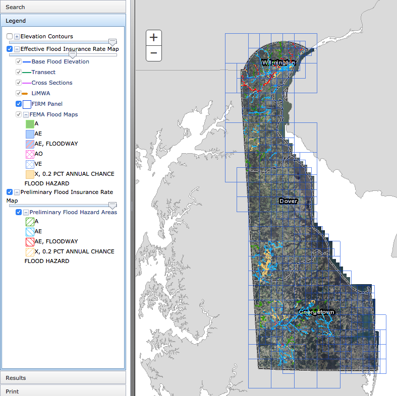
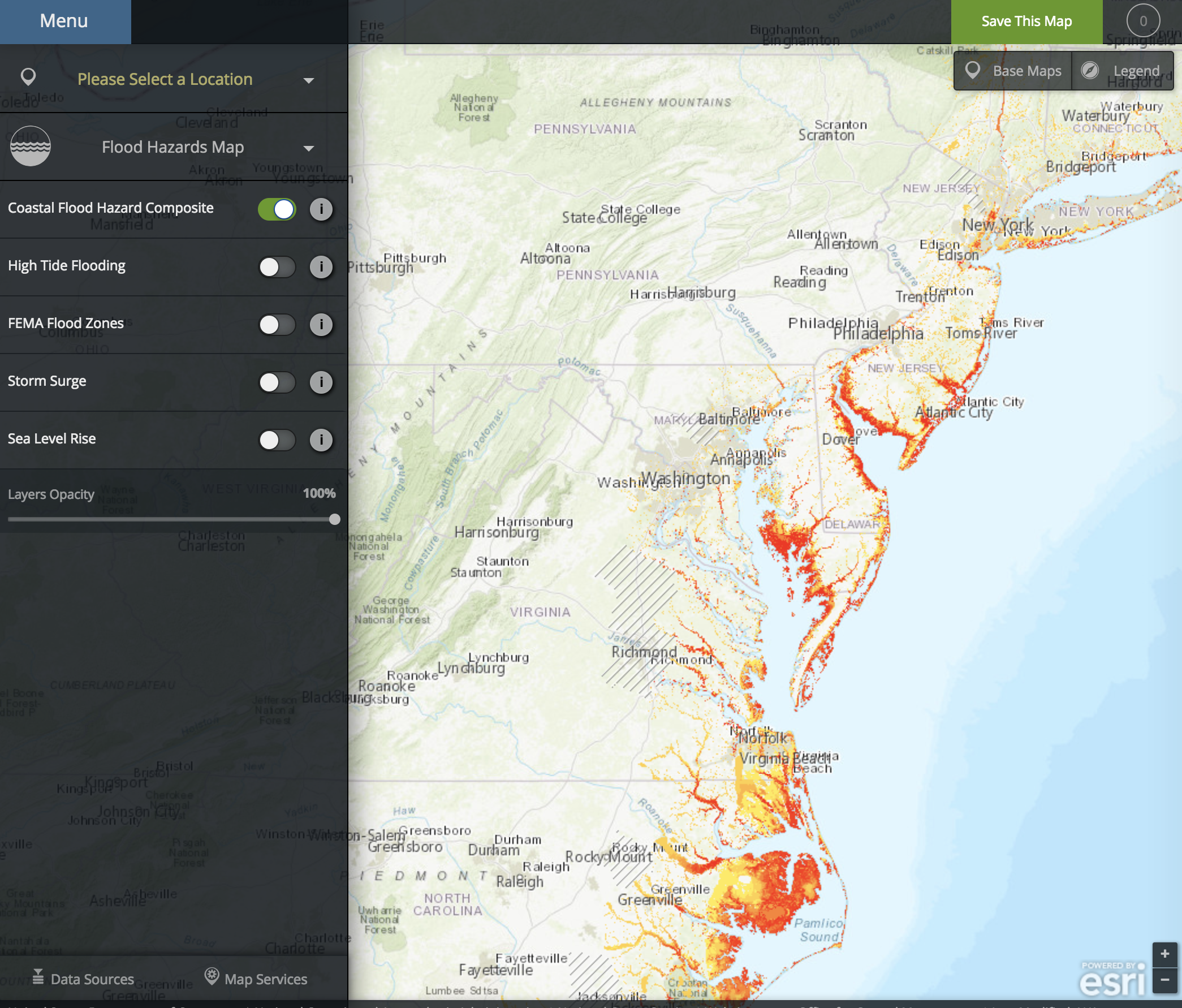
Delaware Flood Planning Tool
The DNREC Flood Tool is an interactive web map application. This tool is designed to aid you in researching your flood risk in the state of Delaware. It is designed to provide floodplain managers, insurance agents, developers, real estate agents, engin …
NOAA Coastal Flood Exposure Mapper
The Coastal Flood Exposure Mapper creates a collection of user-defined maps that show the people, places, and natural resources exposed to coastal flooding.
Delaware Climate Change Projections Portal
Data visualization, data downloads, and general information of downscaled climate projections for Delaware.

University of Delaware Institute for Public Administration (IPA)
The University of Delaware’s Institute for Public Administration (IPA), a center within the School of Public Policy & Administration, addresses the policy, planning, and management needs of its partners through the integration of applied research, …
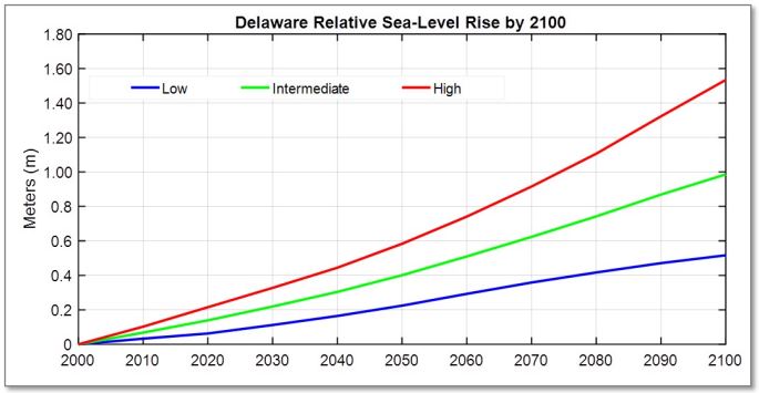
Recommendation of Sea-Level Rise Planning Scenarios for Delaware: Technical Report
This technical report was developed from these efforts summarizing the impacts of SLR in Delaware, recent research on historic SLR reconstructions, data from tide gauges located within the Delaware region, several recent international and national assessments on projecting future SLR conditions, and recommendations of new SLR scenarios to use in Delaware long-range planning activities.
Climate-Conscious Comprehensive Planning in Delaware
This report is written for planners, local government officials, concerned citizens, and decision-makers who are motivated to move their communities forward in a more sustainable and resilient direction through a truly comprehensive development plannin …
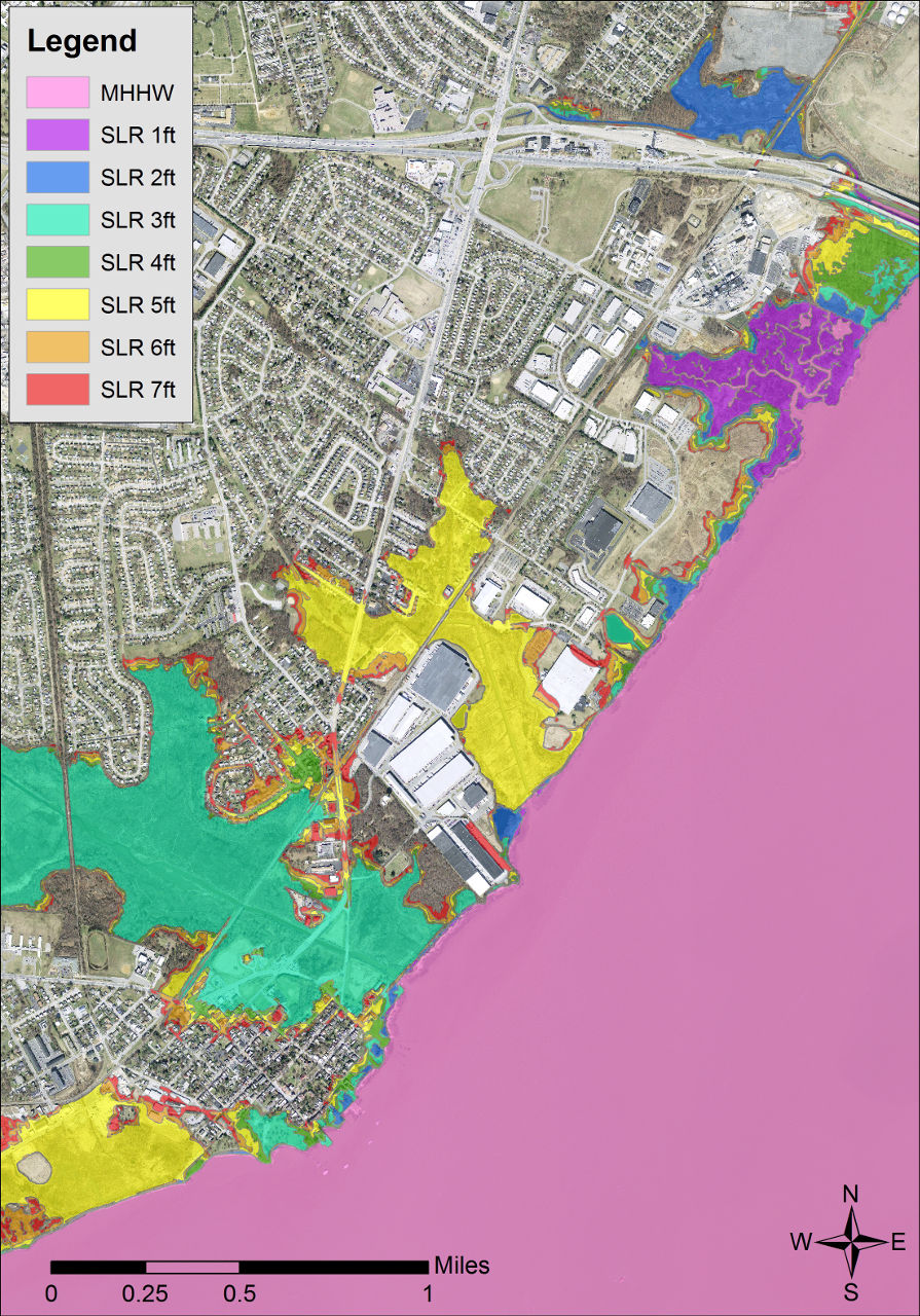
Delaware Coastal Inundation Maps
A new topographic DEM was used to develop bathtub-model coastal inundation maps for the state of Delaware. Both maps and GIS data layers are available from this project.