Search Results
Keyword(s): Vulnerability
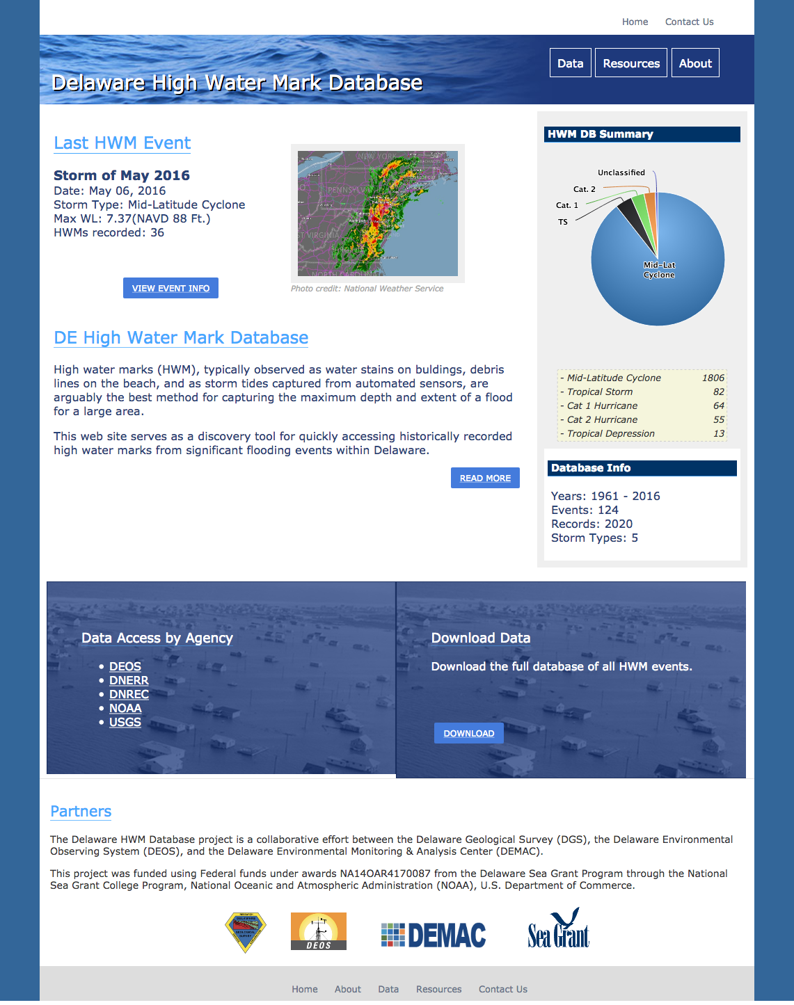
Delaware High Water Mark Database
A database and visualization tool for high water marks observed throughout Delaware as a result of flooding events.
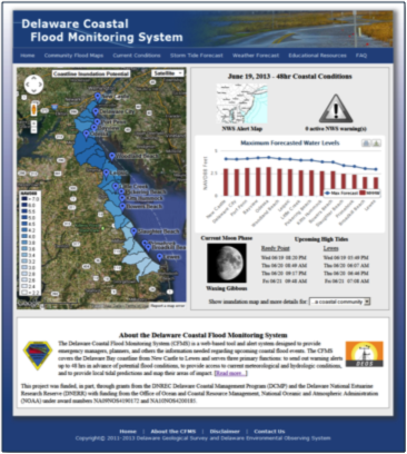
Coastal Flood Monitoring System
The Delaware Coastal Flood Monitoring System (CFMS) is a web-based tool and alert system designed to provide emergency managers, planners, and others the information needed regarding upcoming coastal flood events. The CFMS covers the Delaware Bay coast …
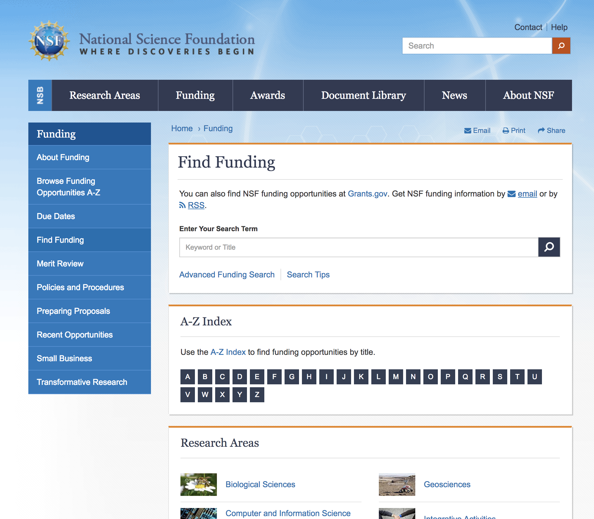
NSF Active Funding Opportunities
Currently active funding opportunities available through the NSF.
NSF: Decision Frameworks for Multi-Hazard Resilient and Sustainable Buildings (RSB)
The goal of the Decision Frameworks for Multi-Hazard Resilient and Sustainable Buildings (RSB) solicitation is to advance knowledge for new concepts for multi-hazard resilient and sustainable SFSE building systems using decision frameworks for selection among alternative building system designs.

Climate-Conscious Comprehensive Planning in Delaware
This report is written for planners, local government officials, concerned citizens, and decision-makers who are motivated to move their communities forward in a more sustainable and resilient direction through a truly comprehensive development plannin …
Coastal Delaware Resiliency
A warming climate, changes in weather patterns, and rising sea levels will change how and where business is done in coastal Delaware. These factors may also provide new business opportunities. This report summarizes the current state of climate science …
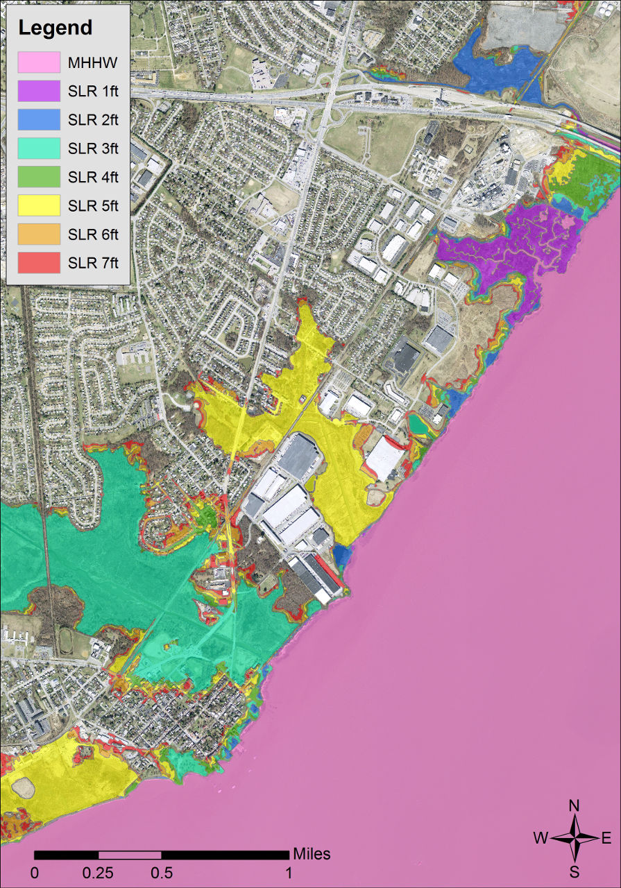
Delaware Coastal Inundation Maps
A new topographic DEM was used to develop bathtub-model coastal inundation maps for the state of Delaware. Both maps and GIS data layers are available from this project.

Climate Action in Delaware: 2016 Progress Report
In September 2013, the Governor signed Executive Order 41: Preparing Delaware for Emerging Climate Impacts and Seizing Economic Opportunities from Reducing Emissions. The Executive Order directed Delaware state government agencies to address both the c …