Search Results
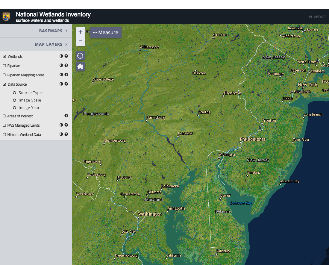
National Wetlands Inventory Wetlands Mapper
The Wetlands mapper is designed to deliver easy-to-use, map like views of America’s Wetland resources. It integrates digital map data along with other resource information to produce current information on the status, extent, characteristics and functi …
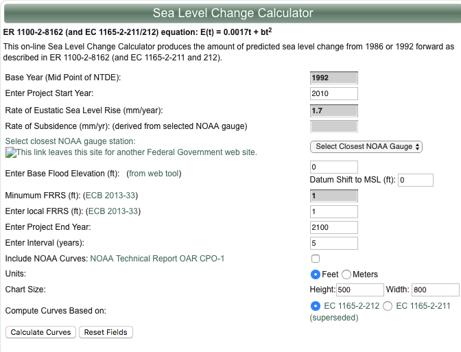
U.S. Army Corps of Engineers Sea-Level Change Curve Calculator
The online Sea Level Change Curve Calculator consists of a web-based tool that accepts user input such as project start date, selection of an appropriate NOAA long term tide gauge, and project life span, to produce a table and graph of the projected se …
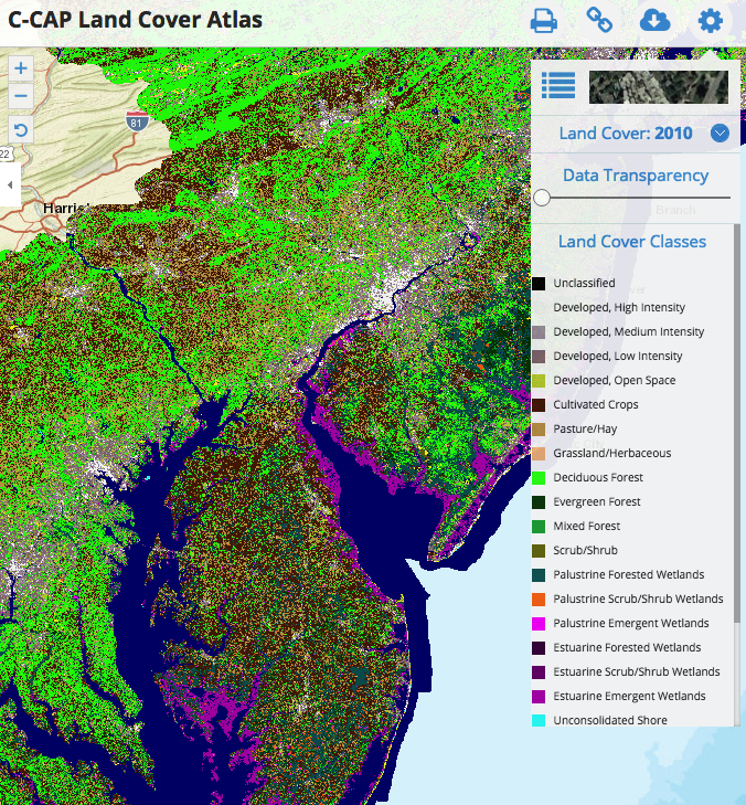
C-CAP Land Cover Atlas
This Data Portal serves as a platform to engage all stakeholders in the five coastal Mid-Atlantic states, putting all of the essential data and state-of-the-art mapping and visualization technology into the hands of the agencies, industry, community le …
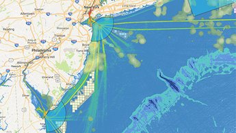
MARCO Map Viewer and Mid-Atlantic Ocean Data Portal
The Mid-Atlantic Ocean Data Portal is an online toolkit and resource center that consolidates available data and enables state, federal, and local users and the general public to visualize and analyze ocean resources and human use information such as f …
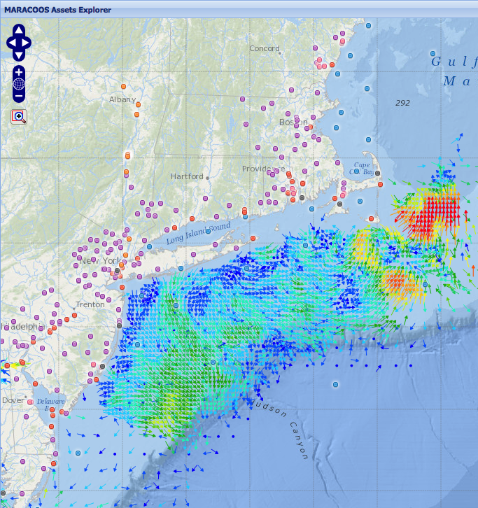
MARACOOS Assets Explorer
This site is designed to present near real-time observational assets and model forecasts that contribute to ocean monitoring in the MARACOOS domain. Numerous geographical representations of datasets are available including: ocean buoys, meteorological …
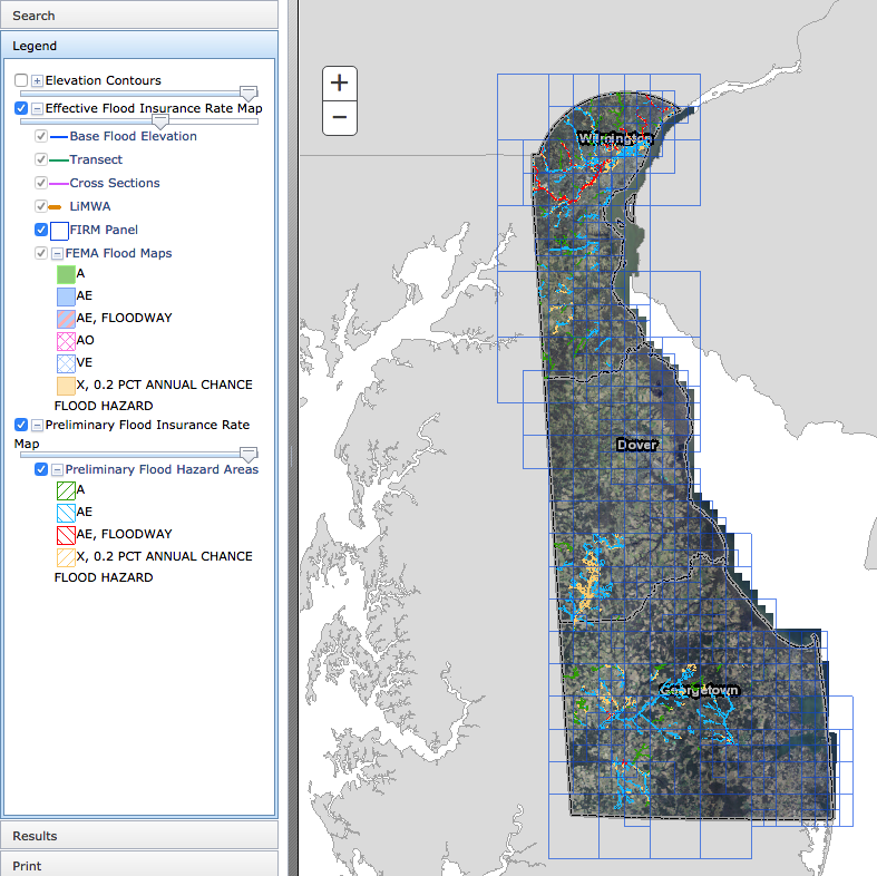
Delaware Flood Planning Tool
The DNREC Flood Tool is an interactive web map application. This tool is designed to aid you in researching your flood risk in the state of Delaware. It is designed to provide floodplain managers, insurance agents, developers, real estate agents, engin …
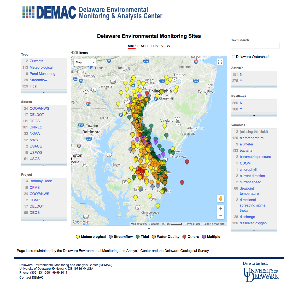
Delaware Environmental Monitoring Sites
An online mapping application that shows current and some past environmental monitoring efforts in and around the State of Delaware.
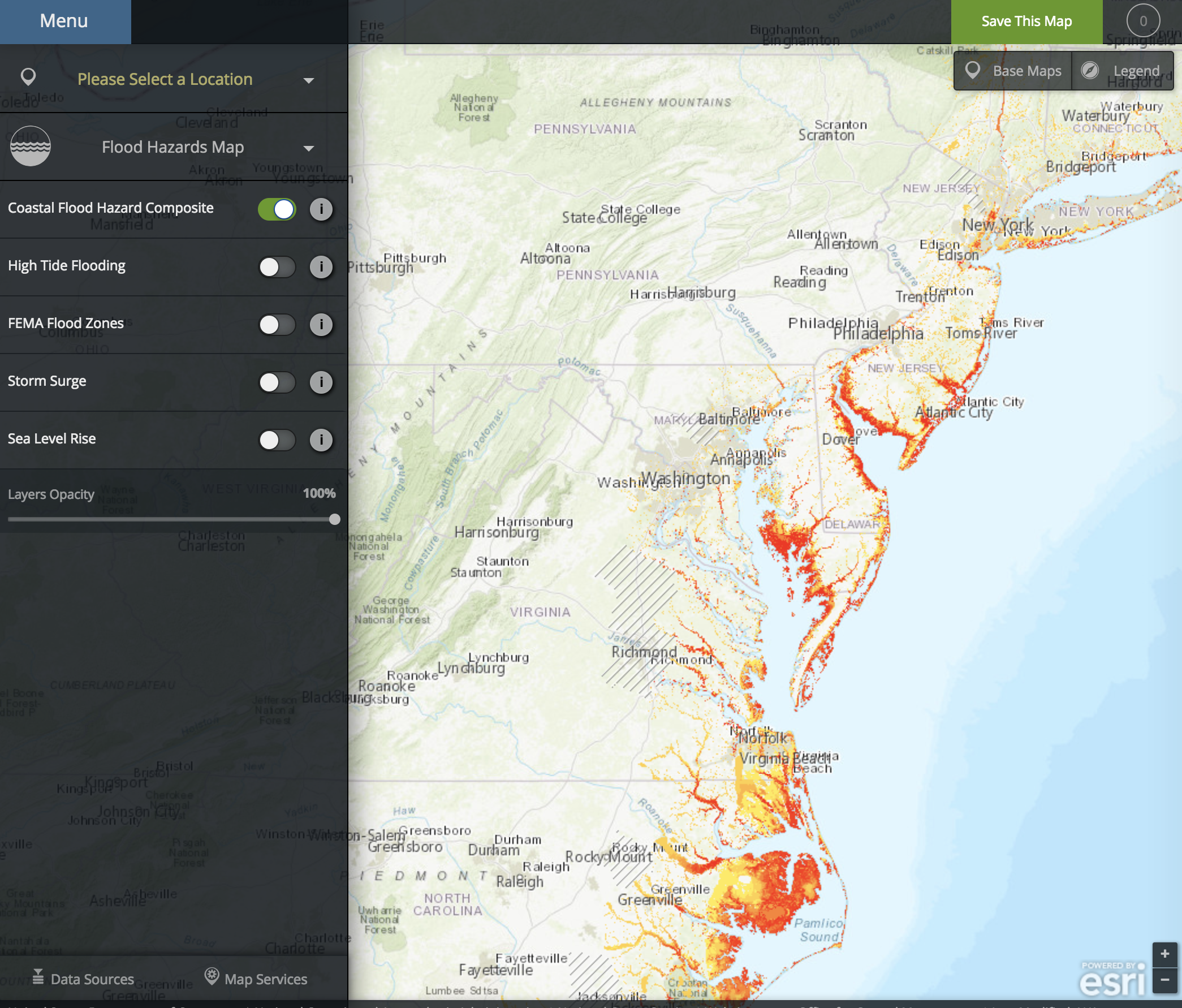
NOAA Coastal Flood Exposure Mapper
The Coastal Flood Exposure Mapper creates a collection of user-defined maps that show the people, places, and natural resources exposed to coastal flooding.
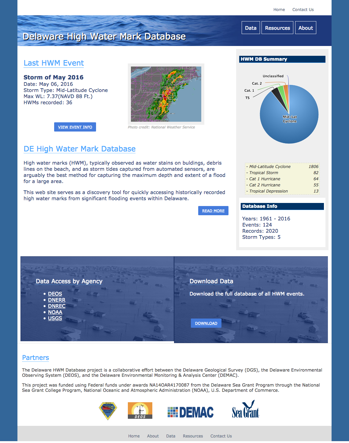
Delaware High Water Mark Database
A database and visualization tool for high water marks observed throughout Delaware as a result of flooding events.

University of Delaware College of Agriculture & Natural Resources
The UD College of Agriculture and Natural Resources plays an exemplary role in fulfilling the Land Grant mission of the University of Delaware.